Monday, 23 July 2018 14:12
Call For Papers for the ACM Symposium on Applied Computing (SAC) 2019 - Information Access and Retrieval Track
For the past 34th years, the ACM Symposium on Applied Computing (SAC) has been a primary and international forum for applied computer scientists, computer engineers and application developers to gather, interact and present their work. The Information Access and Retrieval special track is concerned with the theory, implementation and evaluation…
Read 26034 times
Friday, 06 July 2018 17:12
Special issue “Electric, Magnetic, and Electromagnetic Fields in Biology and Medicine: From Mechanisms to Biomedical Applications” (IJERPH)
The International Journal of Environmental Research and Public Health (IJERPH) - ISSN 1660-4601, Impact Factor 2.145 - covers all the aspects of the environmental sciences, public health, occupational hygiene, and health-related research, in general. The Italian Society of Environmental Medicine (SIMA) is affiliated with IJERPH. This special issue, for which…
Read 26549 times
Wednesday, 09 May 2018 14:50
13 PhD positions in MARIE CURIE Innovative Training Network EMERALD
Within the Marie Skłodowska-Curie Innovative Training Network (MSCA-ITN) EMERALD, funded by the European Union’s Horizon 2020 Research and Innovation Programme, thirteen positions are available on fixed-term contracts for 36 months with a start date in either October 2018 or January 2019, depending on the host institution. EMERALD (ElectroMagnetic imaging for…
Read 30420 times
Friday, 04 May 2018 10:15
EGU Division Outstanding Early Career Scientists Award to Giovanni Ludeno
During the 2018 General Assembly of the EGU (European Geosciences Union), the largest and most important European event in the field of geosciences, held in Vienna from 8 to 13 April, Giovanni Ludeno, a temporary Researcher at IREA in Naples, received the "Division Outstanding Early Career Scientists Award", the prize…
Read 27986 times
Wednesday, 07 February 2018 12:16
Cutting-edge mobile technologies to acquire, analyze and manage volunteered geographic information
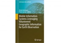
In January 2018, the book “Mobile Information Systems Leveraging Volunteered Geographic Information for Earth Observation”, has been published by Spinger, with editors Gloria Bordogna and Paola Carrara Researchers at IREA. It reports on cutting-edge mobile technologies used to acquire, analyze and manage volunteered geographic information (VGI), outlining new methods and tools to help overcome the…
Read 32460 times
Wednesday, 24 January 2018 13:59
SPECIAL ISSUE “Geoinformatics in Citizen Science” of the ISPRS International Journal of Geo-Information (IJGI)
The International Journal of Geo-Information (IJGI) - ISSN 2220-9964, 2016, Impact Factor 1.502 - is the open access journal of the International Society for Photogrammetry and Remote Sensing (ISPRS) and is published monthly online by MDPI. IJGI provides an advanced forum for geographical information science. The scope of the journal covers all aspects of geographical…
Read 28938 times
Friday, 12 January 2018 12:03
Kick Off Meeting of the EO4GEO European Project
The EU Education, Audiovisual and Culture Executive Agency (EACEA) has approved the project EO4GEO- Towards and innovative strategy for skills development and capacity building in the space geo-information sector supporting Copernicus user uptake. EO4GEO is an Erasmus+ Sector Skills Alliance gathering 26 partners (and initially 22 associated partners, looking forward…
Read 26514 times
Friday, 22 December 2017 10:13
Maria Rosaria Scarfì co-director of the International School of Bioelectromagnetics "Alessandro Chiabrera"
Maria Rosaria Scarfì, a senior researcher of IREA-CNR, was appointed co-director of the International School of Bioelectromagnetics "Alessandro Chiabrera", one of the Schools of the Ettore Majorana Foundation and Center for Scientific Culture (EMFCSC) in Erice (Sicily). From 2003, the year of its establishment, the director was Ferdinando Bersani, professor…
Read 27655 times
Wednesday, 13 December 2017 17:04
Special Issue of the Journal of Sensors
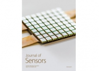
Pasquale Imperatore and Romeo Bernini, researchers at the Institute for Electromagnetic Sensing of the Environment (IREA), are among the editors of the Special Issue "In Situ and Remote Sensors toward Integrated Earth Sensing” of Journal of Sensors. The special issue is dedicated to recent advances, developments and applications in the…
Read 25858 times
Monday, 30 October 2017 16:49
2017: A “hot” summer on Mount Vesuvius !
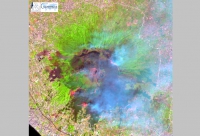
During the 2017 summer season, the Vesuvius National Park was struck by a devastating fire event which caused massive damage to the forest heritage on all flanks of the volcano. Large quantities of ashes resulting from the burning of tens of hectares of Mediterranean scrubs have been dispersed in the…
Read 29991 times


