Ground deformation caused by the earthquake in Turkey October 23, 2011

Researchers at the Institute for Electromagnetic Sensing of the Environment, following the powerful earthquake that struck the eastern province of Turkey on 23 October 2011, processed SAR data acquired by ENVISAT satellite of the European Space Agency (ESA), generating the deformation map caused by the earthquake. In the image each color cycle represents a displacement of about 2.8 cm.

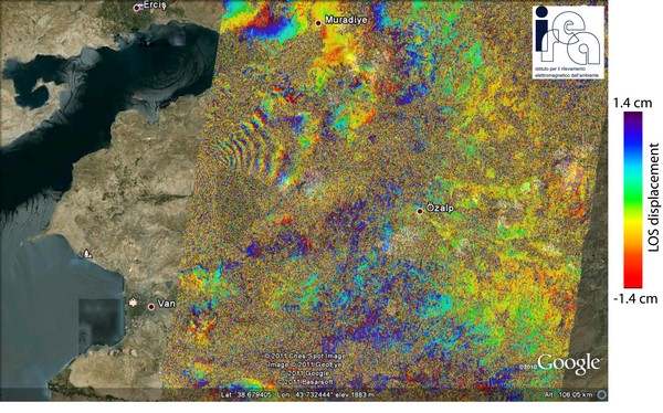
ENVISAT differential interferogram relevant to the area of Van (eastern Turkey) derived from the scenes acquired on 05/10/2010 and 31/10/2011, along descending orbits (Swath: IS6, Track: 121); one color cycle corresponds to about 2.8 cm displacement in the radar line of site. The interferogram has been produced at IREA-CNR (Napoli, Italy) by using the satellite predicted orbits. ENVISAT raw data have been provided by the European Space Agency.


Read 22194 times