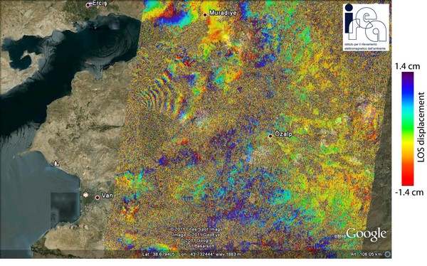
Researchers at the Institute for Electromagnetic Sensing of the Environment, following the powerful earthquake that struck the eastern province of Turkey on 23 October 2011, processed SAR data acquired by ENVISAT satellite of the European Space Agency (ESA), generating the deformation map caused by the earthquake. In the image each color cycle represents a displacement of about 2.8 cm.

ENVISAT differential interferogram relevant to the area of Van (eastern


