
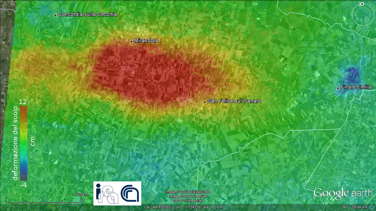
 It is continuing the monitoring activity from space of the areas affected by the earthquake in Emilia Romagna, started by the Civil Protection Department after the beginning of the seismic sequence. The new radar acquisitions by satellites of COSMO-SkyMed constellation, that the Italian Space Agency has planned over the area in which seismic phenomena are taking place, allowed to study the permanent effects of ground movements caused by the quake of May 29, 2012. The study has been conducted by a joint team of researchers from the Institute for Electromagnetic Sensing of the Environment of the National Research Council (IREA-CNR) in Naples and the National Institute of Geophysics and Volcanology (INGV) by using a technique called differential interferometry which allows to measure ground displacements even in the order of a few centimeters over large areas.
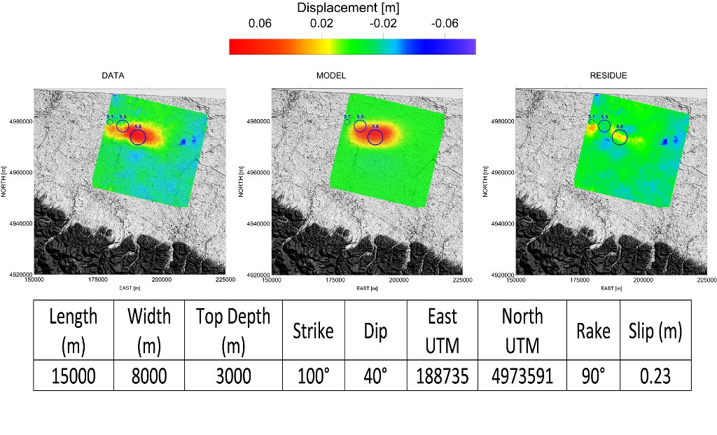
Starting from the information supplied by INGV, researchers at IREA have then realized a model of the source responsible for the observed deformations which describes its shape and location.
