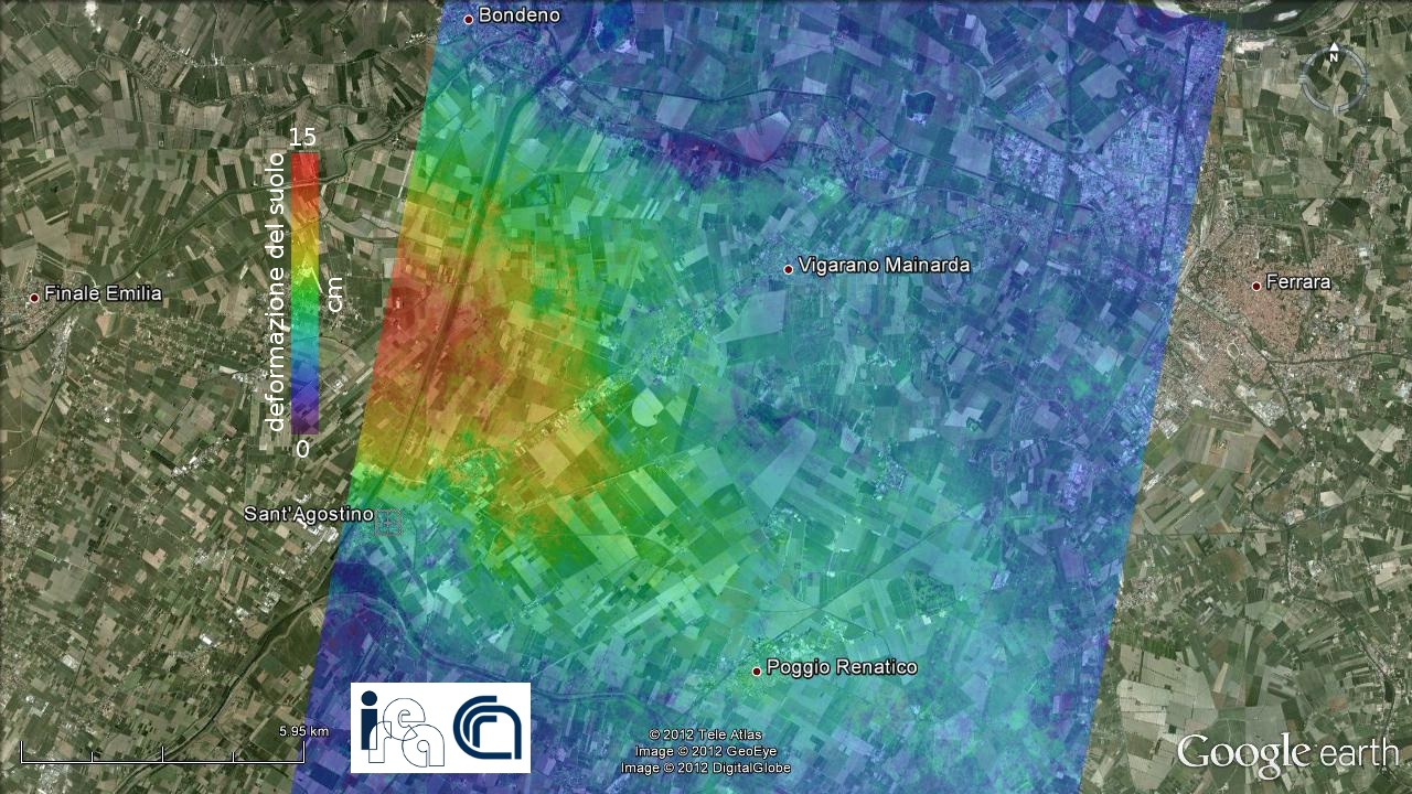
In the emergency after the earthquake in Emilia Romagna, from the earliest hours subsequent the seism the Civil Protection Department involved the Italian Space Agency, the National Research Council - Institute for Electromagnetic Sensing of the Environment and the Institute of Geophysics and Volcanology in order to program new radar acquisitions by satellites of the COSMO-SkyMed constellation to have information in a very short time about the crustal deformation associated with the seismic shocks of greater energy: type of deformation, magnitude and extent of the territory concerned.
Thanks to the satellite information it has been possible to complete the picture of the situation of the area affected by the earthquake. For a part of the studied area there is evidence that there has been an uplift whose maximum value is about 15 centimeters. These data agree with the seismological ones and show a main rupture plan dipping to the south along which the southern part of this area of the Po Valley has overlapped on the northern sector (overthrust fault).


