News in evidence
Wednesday, 02 November 2016 14:40
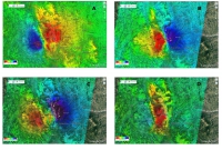
New results on the 30 October 2016 earthquake retrieved from the Sentinel-1 satellite radar data
The study of ground deformation and seismic sources, now focused on the 30 October 2016 earthquake, is enriched with new important results obtained from the processing of radar images collected from the Sentinel-1 constellation along ascending and descending orbits Thanks to the new radar images, acquired on 1 November 2016 from…
Read 42460 times
Saturday, 29 October 2016 15:40
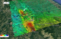
The earthquake of October 26 from satellite acquisitions
The study of The Earth's deformations and seismic sources continues, focusing on the events of October 26. This activity is coordinated by the Department of Civil Protection (DPC) and is carried out by a team of researchers from the Institute for Electromagnetic Sensing of the Environment of the National Research…
Read 33649 times
Tuesday, 30 August 2016 17:45
New results on the Amatrice earthquake of August 24, 2016, obtained from Sentinel-1 and COSMO-SKyMed satellites radars
The study of the ground deformations and seismic sources related to the events of 24 August 2016 is going on. Thie activity is coordinated by the Department of Civil Protection (DPC) and is carried out by a team of researchers from the National Research Council (Institute for Electromagnetic Sensing of the…
Read 37697 times
Friday, 26 August 2016 15:17
Satellite sensing helps to identify the faults of the Amatrice earthquake of 24/08/2016
By exploiting the data of the Japanese satellite ALOS 2, obtained through scientific projects, a team of CNR and INGV researchers (coordinated by Riccardo Lanari, director of CNR-IREA, and by Stefano Salvi, technologist manager of INGV), measured with high precision the permanent ground displacements occurred during the earthquake, using the…
Read 37995 times
Thursday, 07 April 2016 12:03
NASA Space Apps Challenge 2016 in Napoli
Naples is again among the 158 cities of the world in which the fifth International Space Apps Challenge, the big event sponsored by NASA, which will take place on April 23 and 24 at the Faculty of Engineering in Via Nuova Agnano 11. Thanks to the organization supported by IREA, Department…
Read 29698 times
Tuesday, 01 March 2016 14:47
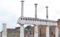
In the archaeological site of Pompeii the school "Geophysics and Remote Sensing for Archaeology"
In the fascinating setting of Pompeii archaeological area, the school "Geophysics and Remote Sensing for Archaeology" will be held from 9 to 13 May 2016. The course is organised by two Institutes of the National Research Council of Italy, i.e. CNR-IBAM and CNR-IREA, and Soprintendenza Speciale Beni Archeologici Pompei, Ercolano…
Read 25836 times
Wednesday, 30 December 2015 17:19
Continental scale mapping capabilities of Sentinel-1 sensor: the 12-days InSAR coherence over Europe
Sentinel-1 is the first satellite of the Copernicus program and is equipped with a Synthetic Aperture Radar (SAR) sensor that is able to provide day-night acquisitions nearly over the whole World. The Sentinel-1 operational mode on land is the so-called Interferometric Wide Swath (IWS), which guarantees the Earth’s global coverage…
Read 49878 times
Friday, 11 December 2015 15:38
Training course on the SBAS-DInSAR web tool for Earth surface deformation analysis
In the frame of the next AGU 2015 Fall meeting IREA-CNR organized a training event on “Training on the SBAS-DInSAR web tool for Earth surface deformation analysis through the ESA Geohazard Exploitation Platform”. The event originates in the context of space-borne geodetic techniques, and will focus on Differential Synthetic Aperture…
Read 53219 times
Friday, 25 September 2015 10:58
New developments for the treatment of cancer with pulsed electric fields: awarded a young IREA researcher
During the "1st World Congress on Electroporation and Pulsed Electric Fields in Biology, Medicine and Food & Environmental Technologies", which was held in in Portoroz (Slovenia) from 5 to 10 September 2015, Dr. Stefania Romeo, a research fellow at IREA in Naples, received the second prize in the category Medicine…
Read 28058 times
Thursday, 24 September 2015 14:21
Earthquake in Chile: the ground deformation measured by processing the data of European satellite Sentinel-1A
An earthquake of magnitude 8.3 struck the central region of Chile, 46 km west of the city of Illapel, at 22:54:33 (UTC) on September 16, 2015. The area is considered one of the regions at highest seismic risk in the world. The seismic activity in the region is caused by…
Read 31367 times
Tag Cloud
Research activity in evidence
-
Sea state monitoring through X-band marine radars
According to a recent study of the European Spatial Agency…


