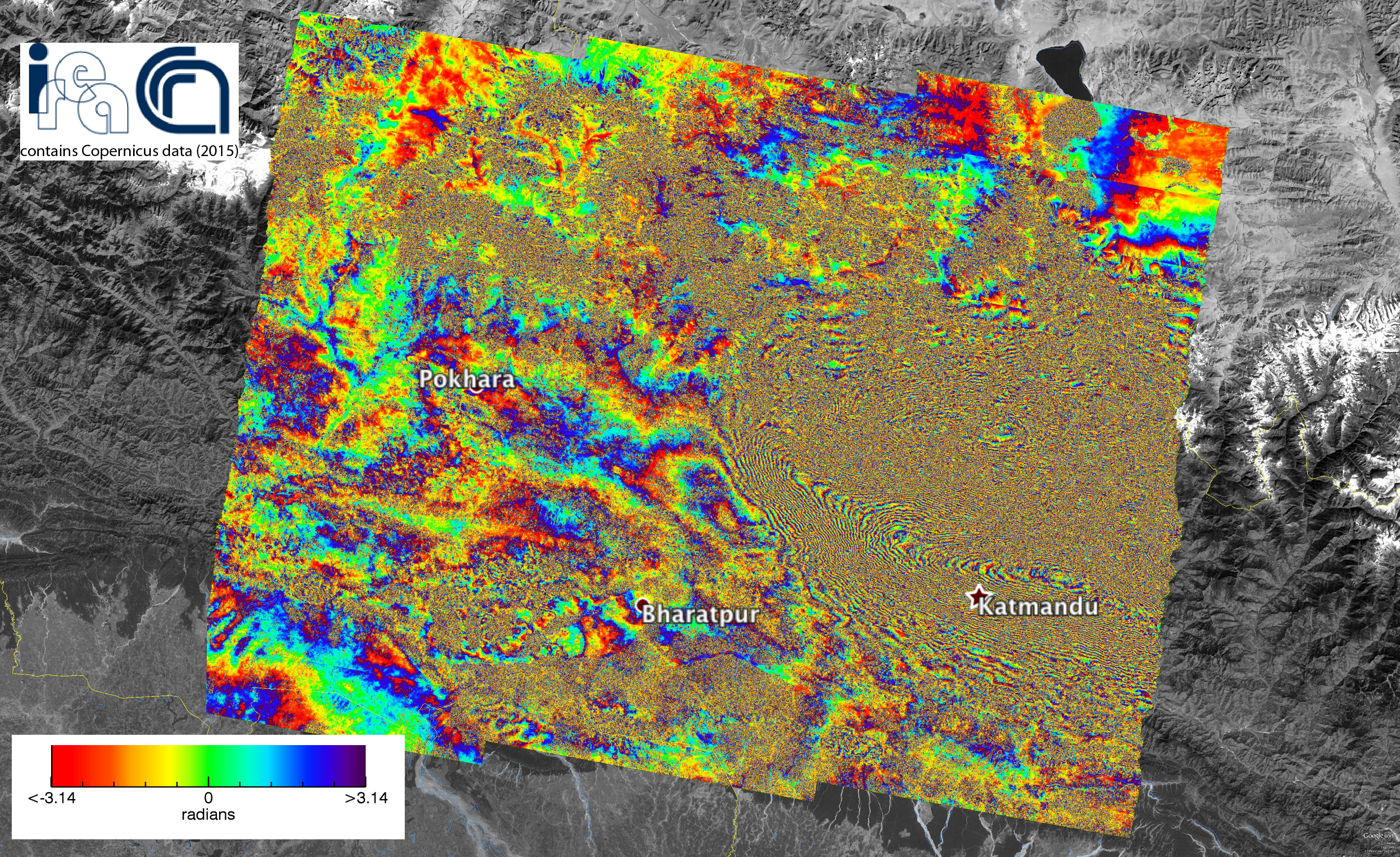
The radar acquisitions of the new generation satellite Sentinel-1A of the European Program Copernicus allowed us to analyze the ongoing seismic phenomena and the permanent effects of the ground movements caused by the violent earthquake of magnitude 7.8 that struck Nepal on April 25, 2015.
The study has been conducted by a team of researchers at the Institute for Electromagnetic Sensing of the Environment of the National Research Council of Naples (IREA-CNR) using differential radar interferometry, the technique which allows to measure ground deformations even in the order of a few centimeters on very large areas from space.
The figure shows the obtained interferogram, ie the map of the surface deformation induced by the earthquake, which is in a time interval ranging from April 17 to April 29, 2015. Each color band (fringe) indicates a ground shift of approximately 3 cm, with a maximum deformation of about 1 m. The displacement occurred as a result of the earthquake and subsequent shocks. It is the surface response to the fault plane displacement in depth.
The activity has been conducted as part of the agreement between IREA-CNR and the Civil Protection Department (DPC), and in the framework of the TEP-Quick Win project (ESA) and I-AMICA (High Technological Infrastructure for Integrated Monitoring of Climate and Environment) project, which is funded by MIUR under the National Operative Programme (PON).
To see the image on google earth click here


