
The study of ground deformation and seismic sources, now focused on the 30 October 2016 earthquake, is enriched with new important results obtained from the processing of radar images collected from the Sentinel-1 constellation along ascending and descending orbits
Thanks to the new radar images, acquired on 1 November 2016 from ascending and descending orbits by the (C-band) sensors of the Sentinel-1 constellation of the Copernicus European Programme, the processing performed by CNR-IREA using the differential radar interferometry technique has now revealed the surface deformation related to the earthquake, in all its extension (about 1100 square kilometers) and complexity.
In particular, by combining the deformation maps obtained by the Sentinel-1 ascending and descending acquisitions (Figure 1A and Figure 1B, respectively) it is possible to estimate both the vertical and east-west displacement components. Two large horizontal deformation lobes are clearly visible (see Figure 1C): the first is centered approximately in the Montegallo zone and exhibits an eastward movement (with a maximum deformation of about 40 cm), the latter is centered in the area of Norcia with westward deformation (with a maximum displacement of about 30 cm).
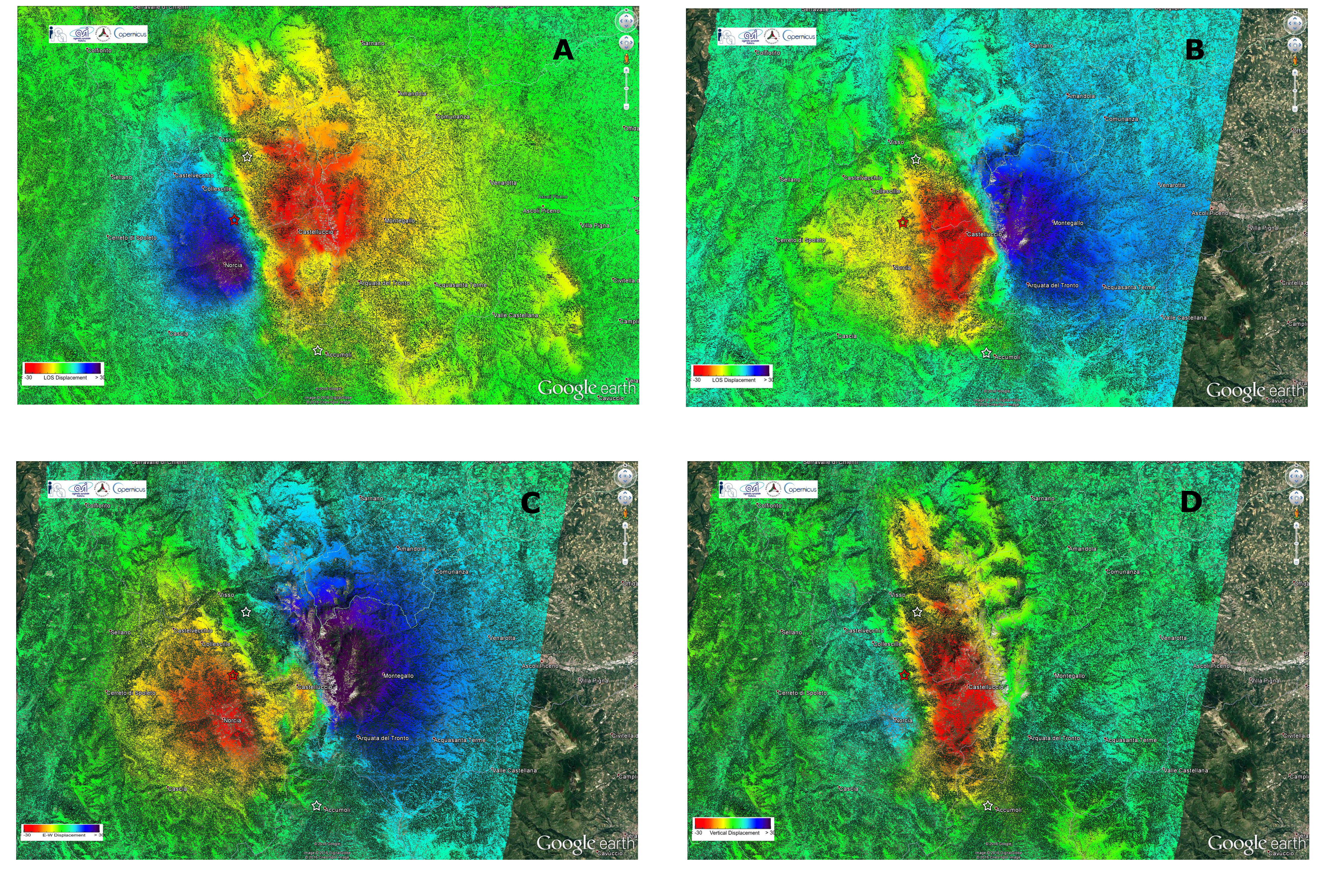
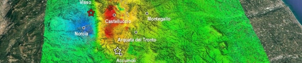
Figure 1 Results of the analyses carried out with Sentinel-1 radar data of the Copernicus Programme through the differential radar interferometry technique: on the top the two co-seismic deformation maps (in the radar line of sight) are presented, obtained from ascending and descending orbits (Panel A and B, respectively) starting from the Sentinel-1 data acquired on 10.26.2016 (pre-event images) and 11.01.2016 (post-event images); on the bottom the maps of the east-west (Panel C) and vertical (Panel D) components of surface deformations are shown, obtained by jointly exploiting the ascending (South-North) and descending (North-South) passages. The red star represents the epicenter of the earthquake of 30 October 2016, the white ones are the epicenters of the events of 24 August and 26 October 2016.
It is also evident a significant vertical deformation (Figure 1D) with a strong subsidence pattern down to 60 cm in the area of Castelluccio (already retrieved from previous analysis of Sentinel-1 data), and an uplift of about 12 cm in correspondence to the area of Norcia. It is worth noting that the deformation pattern related to the area of Norcia was already partially retrieved through the analysis carried out by jointly using the first Sentinel-1 data and those provided by the COSMO-SkyMed constellation (X-band), which was developed by the Italian Space Agency in cooperation with the Italian Ministry of Defense.
Finally, it is pointed out that, due to the considerable amount of the occurred deformation, it is reasonable to assume that the detected displacements are underestimated up to 30%. However, these effects will be corrected thanks to the exploitation of new already planned images that will be acquired in the next coming days, especially those collected by the radar sensor (L-band) onboard the Japanese satellite ALOS 2.
The activity is coordinated by the Italian Department of Civil Protection (DPC) and is performed by a research team of the Institute for Electromagnetic Sensing of the Environment of the National Research Council (CNR-IREA in Naples) and the National Institute of Geophysics and Volcanology (INGV), which are centers of competence in the satellite data processing and seismology sectors, respectively, with the support of the Italian Space Agency (ASI).
The Copernicus programme is led by the European Commission. The European Space Agency is in charge of developing the Sentinel satellites; ESA also operates the two Sentinel-1 satellites.
