
On 8 September 2023 (22:11:00 UTC), a 6.8 magnitude earthquake struck southern Morocco, causing widespread damage and thousands of fatalities. Thanks to an automated processing system developed in the framework of the Satellite data thematic core service (TCS-SATD) of the EPOS-Research Infrastructure (EPOS-RI) [1], it is now possible to shed new light on dramatic phenomena such as this one, providing valuable scientific insight to both scientists and hazards prevention activities. Developed by a team of researchers at CNR-IREA and INGV, the system is triggered by an earthquake occurrence and allows to investigate the surface deformation field induced by the considered seismic events, as well as to characterize the earthquake seismic source.
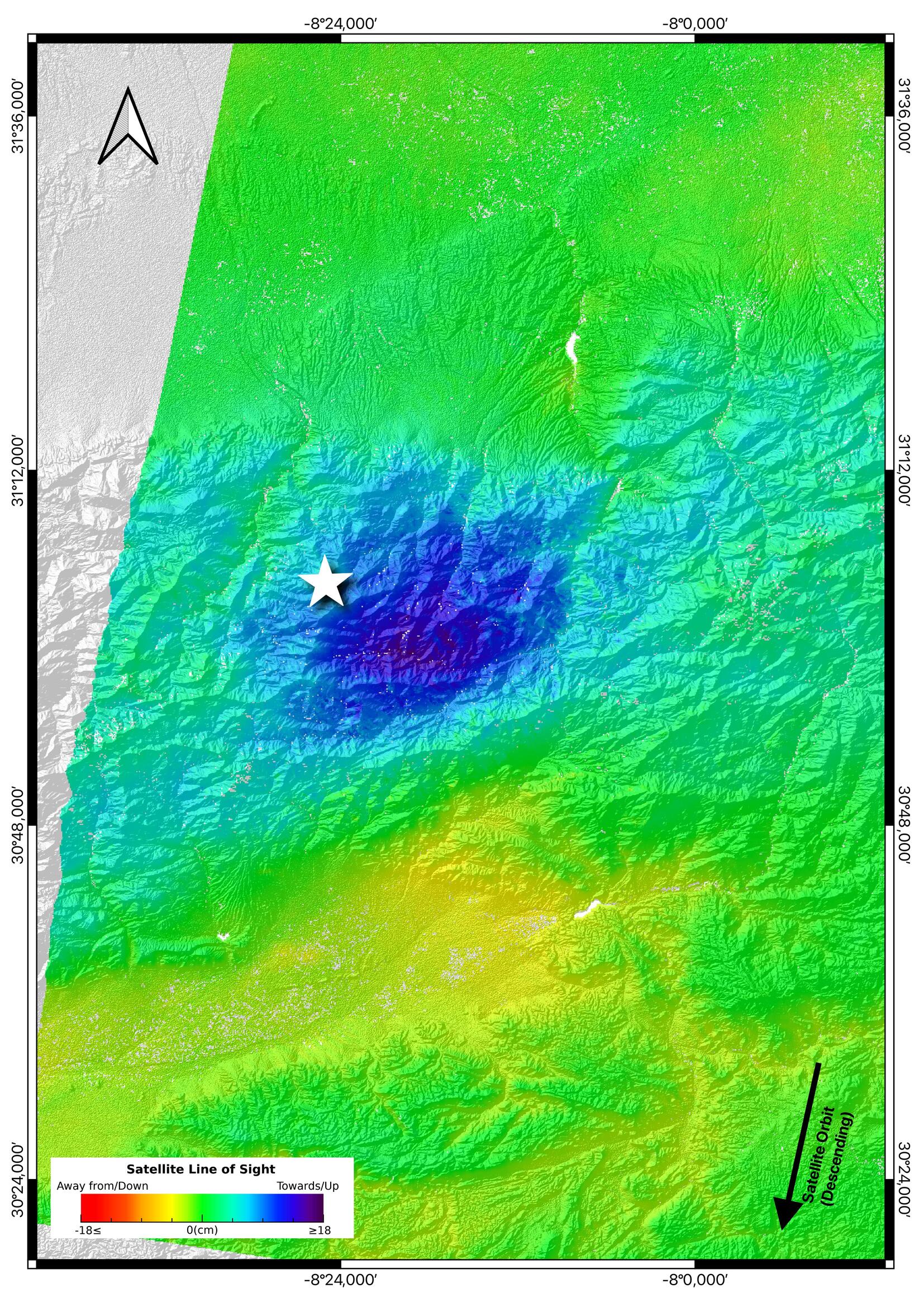 Figure 1. Line-of-sight (LOS) displacement map computed from the Sentinel-1 18082023-11092023 descending data pair (Track 154). The white star indicates the location of the Mw 6.8 epicenter occurred on 8 September 2023 Figure 1. Line-of-sight (LOS) displacement map computed from the Sentinel-1 18082023-11092023 descending data pair (Track 154). The white star indicates the location of the Mw 6.8 epicenter occurred on 8 September 2023 |
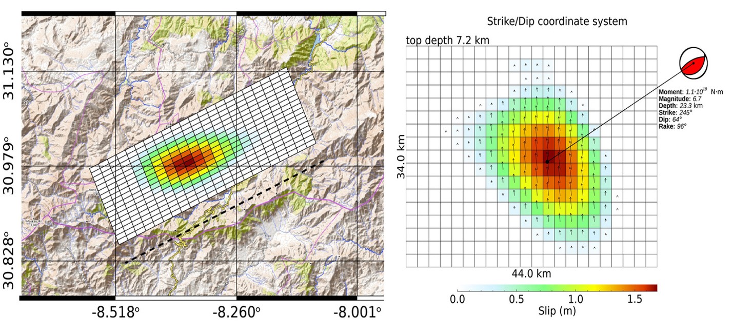
By applying the Synthetic Aperture Radar Interferometry (InSAR) technique to data acquired by the European Sentinel-1A satellite across the event, the system automatically generates a map of the surface displacement induced by the earthquake [2]. The map, presented in Figure 1, shows that the ground experienced a maximum displacement of about 18 cm along the satellite Line-of-Sight (LOS) and a minimum of about -5 cm. This research product is immediately shared with the scientific community through the EPOS Data Portal [3] for further analysis, while being further processed by the system to retrieve also information about the seismic source that originates the earthquake, that resulted to be a North dipping fault with an inverse mechanism and a maximum slip of about 1.7 m, as shown in Figure 2. Seismic source products are presently available at this link [4] and are going to be soon integrated within the TCS-SATD data product portfolio.
The implementation of the described system is the subject of a recent publication [5] carried out through the joint efforts of CNR-IREA and INGV researchers.
|
Figure 2: Slip distribution from geodetic data |
1. EPOS website: https://www.epos-eu.org
2. Monterroso et al. (2020). A Global Archive of Coseismic DInSAR Products Obtained Through Unsupervised Sentinel-1 Data Processing. Remote Sens., vol. 12, no. 3189, pp. 1–21. https://doi.org/10.3390/rs12193189
3. EPOS Data Portal: https://www.epos-eu.org/dataportal
4. http://terremoti.ingv.it/en/finitesource_summary/36092321#SorgenteEstesa
5. Atzori et al. (2023). Automatic seismic source modeling of InSAR displacements. International Journal of Applied Earth Observation and Geoinformation, Volume 123. https://doi.org/10.1016/j.jag.2023.103445