Maria Consiglia Rasulo
A new study conducted by an Italian-American team which includes Francesco Soldovieri, director of the CNR Institute for Electromagnetic Sensing of the Environment, and published in Nature Communications, confirms the hypothesis - put forward for the first time in 2018 – of the presence of liquid salt water in the subsoil of the Red Planet.
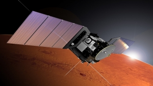
 The discovery of the presence of salt water under the southern polar cap of Mars, made possible thanks to an investigation conducted with the Italian ASI MARSIS radar mounted on board ESA's Mars Express mission, dates back to 2018. The study, carried out by an entirely Italian research team, which also included the Institute for Electromagnetic Sensing of the Environment of the National Research Council (IREA-CNR), was published in the prestigious scientific journal Science.
Two years later another study, published in Nature Astronomy by a multidisciplinary team composed of thirteen researchers including physicists, geologists and engineers, among them Francesco Soldovieri of the IREA-CNR, confirmed the discovery by providing further proof of the existence of saltwater lakes trapped under the ice of the Martian South Pole.
A new study, published on September 28 in Nature Communications by an Italian-coordinated international team, provides now further evidence of the existence of liquid water under the south pole of Mars. In particular, the study was coordinated by the University of Roma Tre and the Institute of Radioastronomy of the National Institute of Astrophysics, with the participation of IREA-CNR together with the University of Southern Queensland (Australia), Southwest Research Institute (USA ) and Planetary Science Institute (USA).
The research concerned the southern Martian polar deposits (the so-called SPLD - South Polar Layered Deposits). The in-depth study and evaluation of the attenuation of the radar signal in the SPLD ice, already detected in the area investigated in the second study, has allowed us to arrive at two important results.
The first is that the attenuation of the MARSIS signal is constant in the entire analyzed region, thus confirming the compositional homogeneity of the polar deposits at the observation scale of the MARSIS radar.
In addition, the estimated attenuation values made it possible to recalculate the value of the reflection coefficient underlying the SPLDs and estimate the relative dielectric permittivity, equal to 40 in the highly reflective area, a situation compatible only with the presence of salt water.
Finally, starting from the estimated attenuation it was possible to obtain important information in terms of dust content in the polar deposits (SPLD), between 5 and 12%, and that the temperature at the base of the SPLD calculated so far had been underestimated. It can easily reach 200K (-73 ° C), ensuring conditions compatible with the presence of salt water in the liquid state.
The set of the results mentioned above, therefore, confirms the presence of salt water at the base of the SPLD as the sole cause of the strong basal reflections in the Ultimi Scopuli region.

An important acknowledgement was given to Rosa Scapaticci, a researcher at CNR-IREA, selected as Associate Editor of the IEEE Transactions on Medical Imaging journal (IF 10.048), as an expert in the field of “Microwave Imaging for Medical Applications”. The aim of the journal is to provide a unifying vision of the sciences of medicine, biology and imaging, as well as to emphasize the synergy between instrumentation, hardware, software, mathematics, physics, biology and medicine through new methods of analysis.
More details on the journal are available at this link.
At this link the complete editorial board
On 6-10 June 2022, SIOF Ottica organizes the "IV National School on Optical Biosensors and Biophotonics - Bio&B” that will be held in Ischia (NA).
It is an Italian initiative to establish a platform for education, discussion and exchange among young researchers working in the field of biosensors and photonics.
Directors: Ambra Giannetti (IFAC-CNR), Maria Grazia Manera (IMM-CNR), Ilaria Rea (ISASI-CNR), Genni Testa (IREA-CNR)
All the details can be found at this link
Call for paper for the Special Issue "Electromagnetic Applications in Industrial and Medicine” of the MDPI open access journal Electronics (ISSN 2079-9292; IF: 2.397; Cite Score 2.7)
Guest Editors: Dr. Roberta Palmeri (IREA-CNR), Prof. Tommaso Isernia (Università Mediterranea of Reggio Calabria), Dr. Colin Gilmore (University of Manitoba, Winnipeg, Canada).
OThe aim of this Special Issue is to collect recent expertise and provide a comprehensive overview of new solutions in applied electromagnetics. Topics of interest include but are not limited to industrial, agricultural and medical tomography, electromagnetic therapy, computational methods, antenna systems and sensors, theoretical and experimental works, and analysis and interpretation of data.
For information see https://www.mdpi.com/journal/electronics/special_issues/electromagnetic_application
-
October 24, 2021. Submission of regular papers and SRC research abstracts
- October 25, 2021. Submission of tutorial proposals
-
November 20, 2021. Notification of tutorials acceptance
-
December 10, 2021. Notification of paper acceptance/rejection
-
December 10, 2021. Notification of SRC acceptance/rejection
-
December 21 , 2021. Camera-ready copies of accepted papers/SRC
-
December 21, 2021 Author registration due date
-
April 26, 2022. SRC Poster exhibit
-
April 27, 2022. SRC Non-SRC Poster program
-
April 28, 2022. SRC Oral presentation
For further information, download the Call for Papers
Call For Papers for the Special Issue "Data Fusion for Remote Sensing of Fires and Floods in the Sentinels Era" of the MDPI Remote Sensing.
Guest Editors: Gloria Bordogna e Daniela Stroppiana
Deadline for manuscript submissions: 30 December 2021.
On 29 December 2020 (11:19:54 UTC), a Mw 6.4 earthquake struck the central Croatia, close to the town of Petrinja, killing seven people, injuring hundreds, and causing widespread damage. This is the largest earthquake occurred in Croatia since the advent of modern seismometers.
This event nucleated along a right-lateral strike-slip fault, known in literature as Petrinja fault, and was preceded by two earthquakes of magnitude 4.7 and 5.2, which occurred on 28 December. In the following hours and days, there were also numerous aftershocks that reached a maximum magnitude of 4.8.
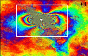
By using the Differential Synthetic Aperture Radar Interferometry (DInSAR) technique, a team of researchers at the Institute for Electromagnetic Sensing of the Environment of the National Research Council of Naples (IREA-CNR) has studied the surface deformation field induced by the considered seismic event. In particular, the data employed to generate the co-seismic interferograms were acquired by the European satellite Sentinel-1 on 18 and 30 December 2020 and on 23 December 2020 and on 4 January 2021 along ascending and descending orbits, respectively (Figure 1a and 1b). Each fringe corresponds to a LOS-displacement of about 2.8 cm, with a maximum deformation of about 40 centimeters.
Starting from these interferograms, the corresponding deformation maps were then derived (Figure 1c and 1d) through appropriate phase unwrapping procedures. In particular, the ascending track (Figure 1c) presents a deformation pattern characterized by LOS negative values down to about −32 cm and LOS positive values up to about 38 cm, indicating a sensor-to-target distance increase and decrease, respectively; moreover, the descending track (Figure 1d) shows a deformation pattern characterized by both negative LOS displacement values down to about −16 cm and positive LOS displacement values up to about 29 cm.
The availability of both ascending and descending SAR dataset and their consequent combination allow to discriminate the vertical and east–west components of the displacement. In particular, the vertical displacement map shows (Figure 1e) an area affected by a maximum subsidence of -13 cm and an uplifted one with maximum values of 19 cm; moreover, the horizontal displacement map shows a maximum displacement of 43 cm to the west and 42 cm to the east.
The activity has been conducted as part of the 2019-2021 CNR-IREA and DPC (Department of Civil Protection) agreement, the EPOS (European Plate Observing System) project, and I-AMICA (High Technological Infrastructure for Integrated Monitoring of Climate and Environment) project, which is funded by MIUR under the National Operative Programme (PON). The Sentinel-1 data have been provided through the Copernicus Program of the European Union.
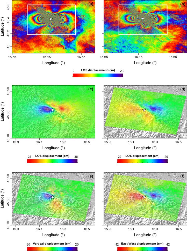
Figure 1. a) Sentinel-1 interferogram relevant to the 18122020-30122020 ascending pair (Track 146). b) Sentinel-1 interferogram relevant to the 23122020-04012021 descending pair (Track 124). The white rectangle represents the area shown in the following panels. c) Line-of-sight (LOS) displacement map computed from the Sentinel-1 interferogram of Figure 1a. d) LOS displacement map computed from the Sentinel-1 interferogram of Figure 1b. (e) Vertical and (f) East-West ground displacements maps. The white star indicates the location of the Mw 6.4 earthquake epicenter occurred on 29 December 2020.
Tag Cloud
Research activity in evidence
-
Electromagnetic fields in clinical diagnostics and therapy
The study of the interaction between electromagnetic fields and biological…


