
Maria Consiglia Rasulo
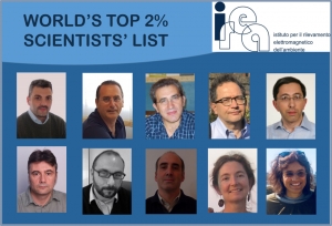
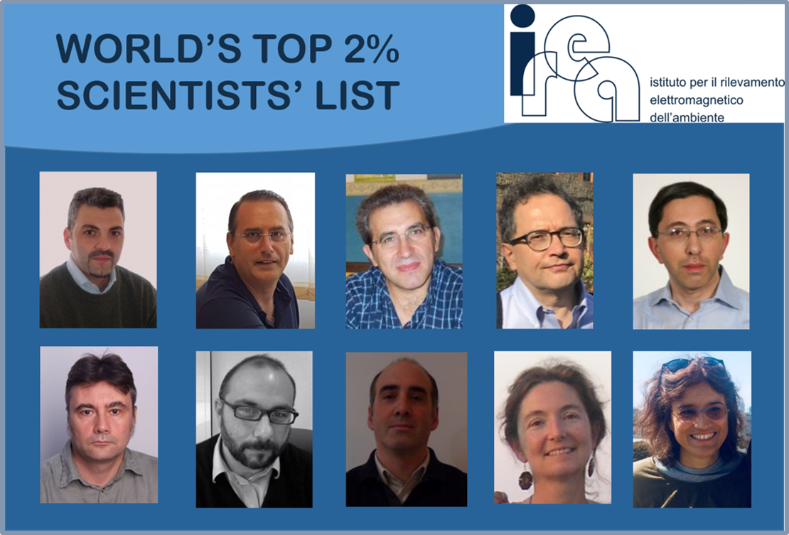 With 10 researchers, CNR-IREA (Institute for Electromagnetic Sensing of the Environment) renewed its presence in the world ranking of the best international scientists drawn up by researchers at Stanford University and published in the prestigious scientific journal PLOS Biology.
The list of the world's “Top Scientists” contains 210,199 names of scientists who fall into the top 2% in their specific research areas. The evaluation is based on the statistical analysis of the quantity, quality and diffusion of scientific publications by over 6 million researchers from universities and research centers around the world grouped in 22 scientific fields and 174 subfields.
In the list of those who have distinguished themselves for the scientific impact of their research, considered throughout their careers until December 2022, there are Gianfranco Fornaro, Riccardo Lanari, Eugenio Sansosti, Francesco Mattia and Antonio Pepe (Geological & Geomatics Engineering area), Francesco Soldovieri and Lorenzo Crocco, (Networking & Telecommunications), Romeo Bernini (Optoelectronics & Photonics), Gloria Bordogna, (Artificial Intelligence & Image Processing). To these is added Claudia Giardino (Geological & Geomatics Engineering), who is present in the "single year 2022" list that considers the scientific productivity of 2022.
The important recognition rewards the constant commitment of IREA researchers and confirms the high quality of the Institute's scientific research.
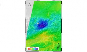
On 8 September 2023 (22:11:00 UTC), a 6.8 magnitude earthquake struck southern Morocco, causing widespread damage and thousands of fatalities. Thanks to an automated processing system developed in the framework of the Satellite data thematic core service (TCS-SATD) of the EPOS-Research Infrastructure (EPOS-RI) [1], it is now possible to shed new light on dramatic phenomena such as this one, providing valuable scientific insight to both scientists and hazards prevention activities. Developed by a team of researchers at CNR-IREA and INGV, the system is triggered by an earthquake occurrence and allows to investigate the surface deformation field induced by the considered seismic events, as well as to characterize the earthquake seismic source.
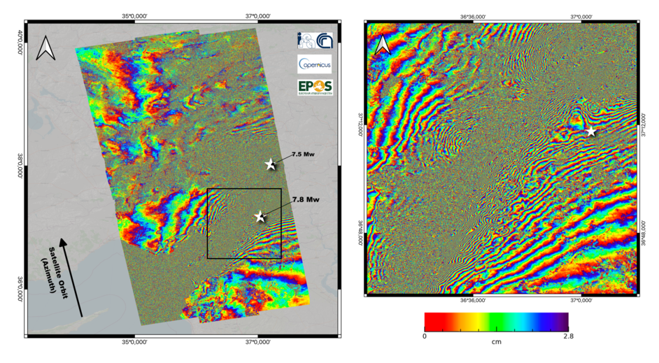
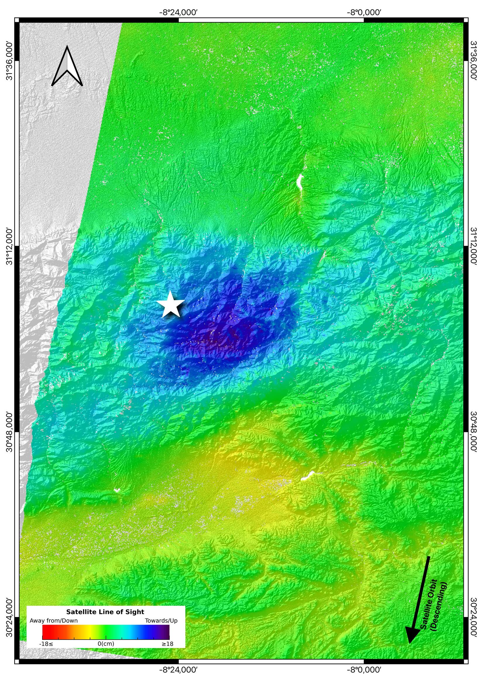 Figure 1. Line-of-sight (LOS) displacement map computed from the Sentinel-1 18082023-11092023 descending data pair (Track 154). The white star indicates the location of the Mw 6.8 epicenter occurred on 8 September 2023 Figure 1. Line-of-sight (LOS) displacement map computed from the Sentinel-1 18082023-11092023 descending data pair (Track 154). The white star indicates the location of the Mw 6.8 epicenter occurred on 8 September 2023 |
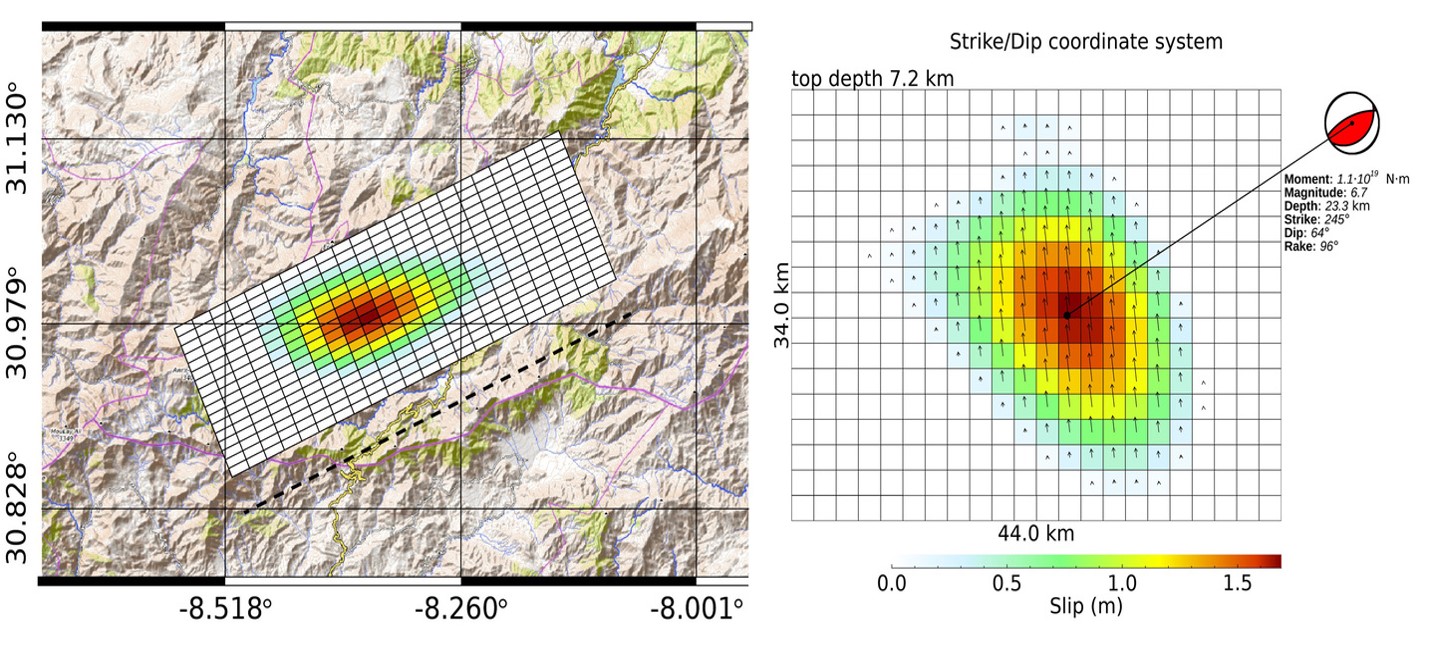
By applying the Synthetic Aperture Radar Interferometry (InSAR) technique to data acquired by the European Sentinel-1A satellite across the event, the system automatically generates a map of the surface displacement induced by the earthquake [2]. The map, presented in Figure 1, shows that the ground experienced a maximum displacement of about 18 cm along the satellite Line-of-Sight (LOS) and a minimum of about -5 cm. This research product is immediately shared with the scientific community through the EPOS Data Portal [3] for further analysis, while being further processed by the system to retrieve also information about the seismic source that originates the earthquake, that resulted to be a North dipping fault with an inverse mechanism and a maximum slip of about 1.7 m, as shown in Figure 2. Seismic source products are presently available at this link [4] and are going to be soon integrated within the TCS-SATD data product portfolio.
The implementation of the described system is the subject of a recent publication [5] carried out through the joint efforts of CNR-IREA and INGV researchers.
|
Figure 2: Slip distribution from geodetic data |
1. EPOS website: https://www.epos-eu.org
2. Monterroso et al. (2020). A Global Archive of Coseismic DInSAR Products Obtained Through Unsupervised Sentinel-1 Data Processing. Remote Sens., vol. 12, no. 3189, pp. 1–21. https://doi.org/10.3390/rs12193189
3. EPOS Data Portal: https://www.epos-eu.org/dataportal
4. http://terremoti.ingv.it/en/finitesource_summary/36092321#SorgenteEstesa
5. Atzori et al. (2023). Automatic seismic source modeling of InSAR displacements. International Journal of Applied Earth Observation and Geoinformation, Volume 123. https://doi.org/10.1016/j.jag.2023.103445
HERITAGE journal, founded in 2018 by Nicola Masini (Cnr-Ispc) and Francesco Soldovieri (Cnr-Irea), who are also its Editors in Chief, received its first Impact Factor of 1.7 in the Journal Citation Reports (Clarivate) last June.
HERITAGE is a monthly Open Access journal, indexed in Scopus, ESCI (Web of Science), and other databases. HERITAGE is dedicated to the issues of knowledge, conservation, management and protection of cultural and natural heritage, with a holistic approach ranging from technologies, best practices and social sciences.
The journal was founded with the idea of encouraging synergistic connections between different disciplines, technologies, themes, application scenarios, approaches (from multidisciplinary to trans-disciplinary), enhancing the areas of cultural and natural heritage, which increasingly represent a frontier area for new methodological and technological advances of interest also in other sectors of knowledge.
For more information about the magazine, go to this link.
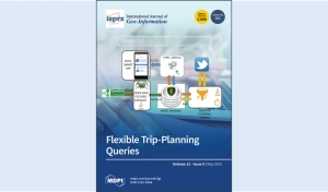
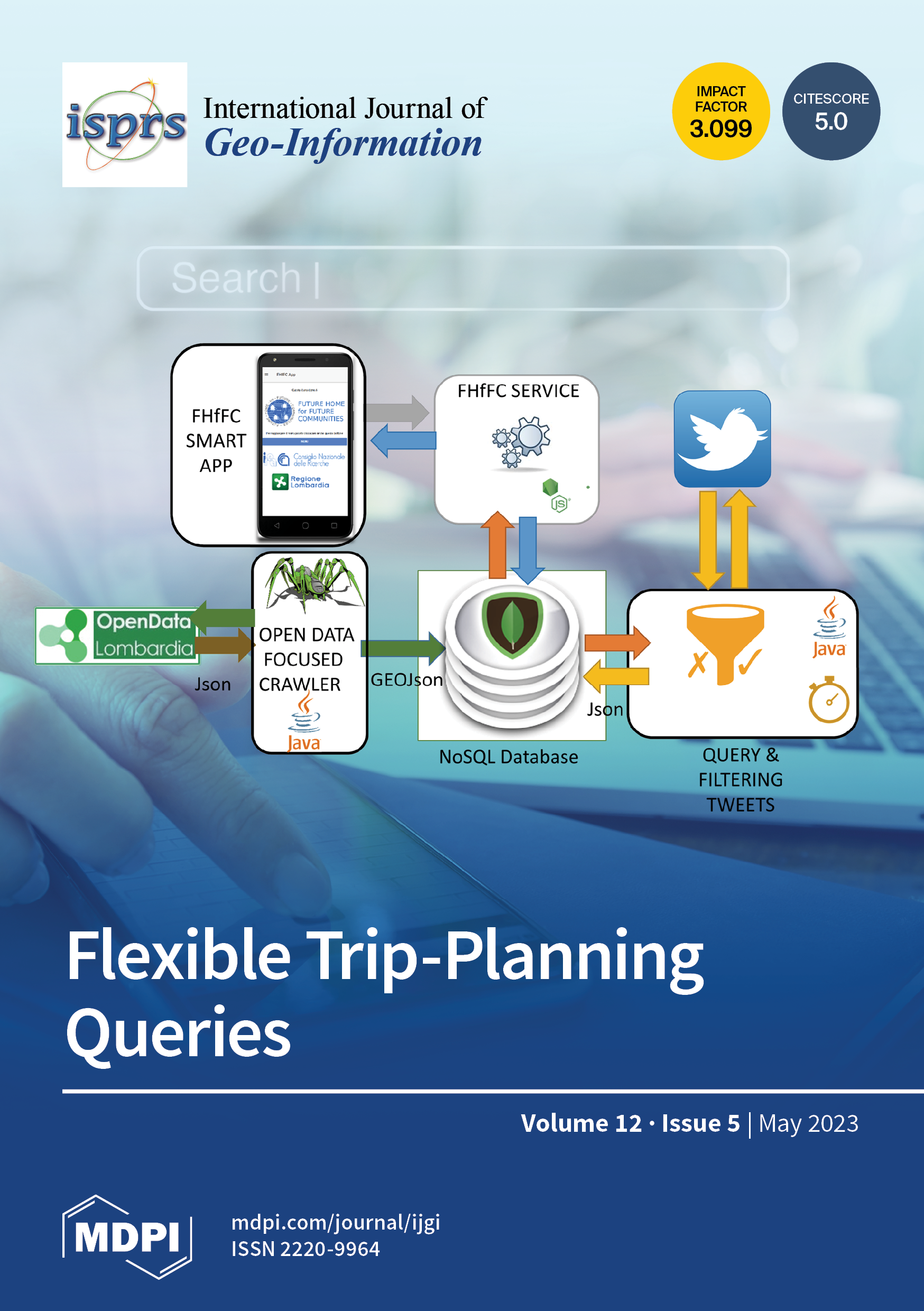
The article “Flexible Trip-Planning Queries”, by Gloria Bordogna, Paola Carrara, Luca Frigerio and Simone Lella of CNR-IREA, has been selected by the ISPRS International Journal of Geo-Information (IJGI) as the cover story of Volume 12 (Issue 5, May 2023), which contains 29 articles devoted mostly to themes and problems of geographic information systems.
In the context of high social mobility, in which people frequently change their place of life, for both work and tourism, and services present in an area (such as shops) change rapidly, there is a growing need for systems that allow users to be quickly and constantly aware of local resources. In such a context, the current practice of searching on the Internet for different types of geo-resources in a geographic area, to identify the most convenient routes for visiting the most relevant ones, is inadequate since it requires the iterative formulation of several queries.
To perform this task within a Geographic Information Retrieval (GIR) system, the article proposes “flexible trip planning queries”, which allow users to formulate a single query to identify the most relevant resources of the types of interest and to rank alternative routes to visit them by taking into account users’ preferences and visit priorities.
The algorithm is applied in the Smart cOmmunity-based Geographic infoRmation rEtrievAl SysTem (SO-GREAT) system, developed in IREA to empower local communities: in fact, it collects and manages open data made available by both regional and local authorities in the Lombardy region that describe local resources and services (such as schools, hospitals, etc.) and voluntary geographic services in which citizens offer services in the neighbourhood.


IElectric, magnetic, and electromagnetic fields (EMF) are widely used in everyday life and in specific occupational environments. EMF-based technologies employ different parts of the spectrum, from static fields to low and high frequency electromagnetic fields encompassing millimeter waves and THz.
Exposure to these fields raises concerns about the possible effects on human health, especially due to the diffusion of 5G networks, which are expected to have a major impact on exposure scenarios. On the other hand, biomedical applications of non-ionizing radiations are successfully employed for diagnosis and therapy (e.g., electroporation-based treatments, microwave hyperthermia, etc.). There is great interest in evaluating the associated interaction mechanisms, which are also relevant to foster the development of new biomedical applications or the optimization of the existing ones.
The Special Issue "Electric, Magnetic, and Electromagnetic Fields in Biology and Medicine: From Mechanisms to Biomedical Applications, Volume II" of the journal Bioengineering, whose guest editors are Stefania Romeo and Anna Sannino of CNR-IREA, is open to scientific studies addressing in vitro, in vivo, and epidemiological investigations on electric, magnetic, and electromagnetic exposure aimed at evaluating possible health effects, the beneficial potential of such fields for diagnosis and therapy, and studies focusing on interaction mechanisms.
More information is available at this link


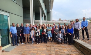
 The third Plenary Meeting and the second Technical Workshop of the NextGEM (Next Generation Integrated Sensing and Analytical System for Monitoring and Assessing Radiofrequency Electromagnetic Field Exposure and Health) project have just concluded. NextGEM is funded by the European Commission under the Horizon Europe programme and involve the Bioelectromagnetism group of IREA.
The two meetings, held in Naples on 9 and 10 May at the CNR-STEMS headquarters, were an opportunity to present the activities carried out so far within the project and further develop synergies between the partners of the 20 institutions involved for the achievement of the project goals.
The aim of NextGEM is to develop guidelines for citizens and public authorities regarding exposure to electromagnetic fields (EMF) and to provide rapid and reliable access to relevant scientific knowledge on the subject. Indeed, the adoption of new telecommunications technologies, such as 5G, requires in-depth studies and the updating of scientific evidence on the potential health risks of electromagnetic fields.
The NextGEM project responds to this need by combining the scientific research dimension with a more strictly technological one. The first is aimed at estimating the effects of EMF exposure through experimental studies on humans, small organisms and cultured cells. The second is aimed at defining methodologies and quality criteria for assessing exposure to electromagnetic fields, health risks and interaction mechanisms.
NextGEM also aims to achieve adequate and effective communication that can improve awareness among authorities, citizens and stakeholders by countering disinformation on this issue.
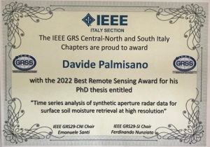
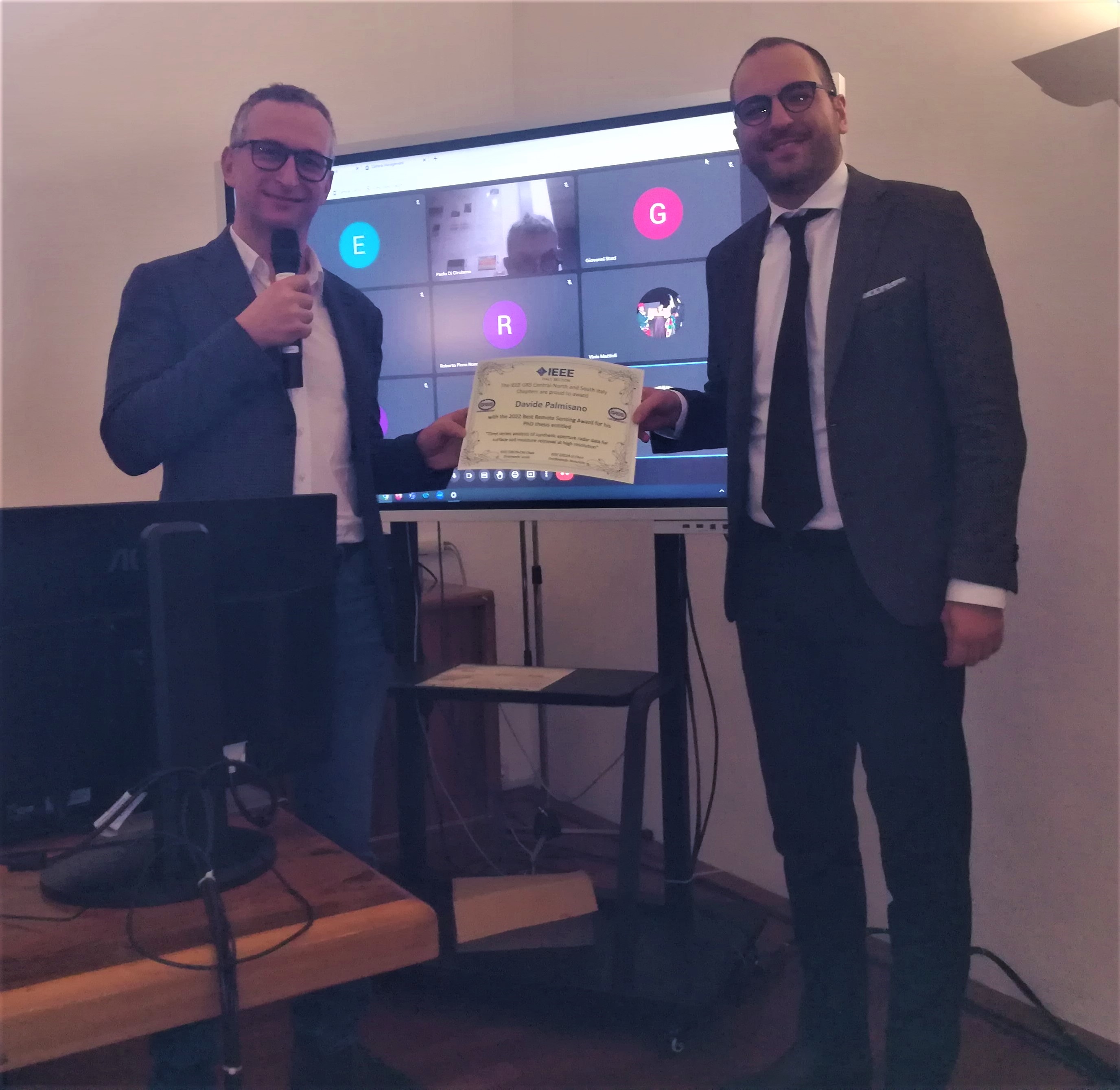
The ceremony of Italy’s Best Remote Sensing Award (IEEE-GRS29) was held in March 2023. The competition, jointly organized again this year by the IEEE Geoscience Remote Sensing Central-North Italy (GRS29-CNI) and South Italy (GRS29-SI) Chapters, saw the awarding of the three best PhD theses and the three best M.Sc. theses on topics of Geoscience and Remote Sensing, defended from 1st of June, 2021 to 31st of May, 2022. Among this year’s candidates, Davide Palmisano has been the winner of the PhD thesis “Time series analysis of synthetic aperture radar data for surface soil moisture retrieval at high resolution” carried out at CNR-IREA and defended at Sapienza University of Rome in February 2022.
The thesis has investigated the use of dense time series of synthetic aperture radar (SAR) data for retrieving SSM at high spatial and temporal resolution. The topic is of great scientific and application interest because it bears on understanding the hydrological cycle and improving land applications, such as numerical weather prediction (NWP), flood forecasting, and drought monitoring and prediction.
The Thesis has focused on three thematic insights. The first one has concerned with the retrieval of Surface Soil Moisture (SSM) over agricultural soils using SAR data from the European mission Sentinel-1, acquired at incidence angles higher than 40 degrees. Indeed, the incidence angle is a crucial parameter modulating the SAR data sensitivity to SSM. Davide’s activity has consisted of quantifying the SSM retrieval accuracy as a function of the incidence angle and the agricultural crop. The sensitivity analysis to SSM has been further investigated in the project “SARSense”, funded by the European Space Agency (ESA), organized in view of the future ROSE-L mission. In particular, Davide has been participating in the data collection during the campaign on the Selhausen site (Germany) and has contributed to the data analysis.
A second important focus of the thesis has been on developing a mathematical scheme for SSM retrieval that combines the information content of temporal changes of the SAR interferometric phase and intensity. The underlying motivation is the new availability of dense time series of SAR data that makes timely the integration of incoherent and coherent change detection approaches for surface parameter retrieval.
A third pillar of the thesis concerns the experimental assessment of SAR SSM through in situ measurements. Worldwide, there exist several hydrologic networks, continuously recording in situ SSM, which are used to test the accuracy of retrieved SSM from satellite data. In the near future, various SAR SSM products will likely be available on a large scale on a continuous temporal basis. Davide has investigated aspects related to the development of validation protocols tailored to high spatial resolution SSM products.
Currently, Davide is an assistant researcher at the IREA’s Bari office, where he pursues his research on the retrieval of land biophysical parameters from earth observation data.
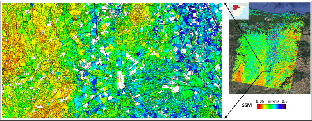
SSM map at ~100 m resolution over Castilla y León, Spain, on 17th of June, 2021. SSM was retrieved using the SMOSAR code (Soil MOisture retrieval from multi-temporal SAR data) developed at CNR-IREA. Left panel: zoom of the SSM map over an agricultural area (parcel borders are in black). Right panel: SSM over the entire area. Higher SSM due to precipitations is in blue. In the inset, the Castilla y León region is reported in red.
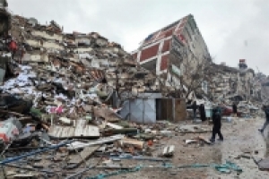
 Following the two seismic events of February 6, 2023, that devastated South-East Turkey and Northern Syria and caused tens of thousands of victims and incalculable damage, a team of researchers from the Institute for Electromagnetic Sensing of the Environment of the National Research Council (IREA-CNR) has detected the surface deformation field induced by the considered seismic events by applying the Differential SAR Interferometry (DInSAR) technique. This result has been achieved thanks to a system developed by IREA-CNR as part of EPOS (European Plate Observing System) activities, the European research infrastructure for the solid Earth study. This system makes it possible to generate DInSAR products automatically, following particularly significant seismic events.
In particular, a co-seismic interferogram was generated (see Figure 1) by analyzing the radar images of the European Sentinel-1A sensor that operates at a wavelength of about 5.6 cm in the C-band of the microwaves. The images were acquired on January 28 and February 9, 2023. Each "fringe" of the interferogram in the Figure, i.e. each color cycle, corresponds to a shift in the sensor Line Of Sight (LOS) of about 2.8 cm, equal to half the wavelength used. The investigated area extends for 130,000 Km2, of which about 35,000 are affected by significant deformation phenomena testified by the presence of interferometric fringes that in many areas are very dense (see the zoom in Figure 1) due to the displacements, even of several meters, caused by seismic events.
New images of the Sentinel-1A sensor, taken from different orbits, are expected in the next few days and will allow further analyses. Furthermore, a series of acquisitions of radar images carried out by the radar sensors of the Argentine constellation SAOCOM-1, operating in the L-band of microwaves with about 23 cm of wavelength, have already been programmed in collaboration with the Italian and Argentine Space Agencies. They will further extend the results obtained thanks to the analysis based on Sentinel-1A data.
The generated results will be made available through the EPOS portal
Sentinel-1 data was provided through the European Copernicus programme
Figure 1: Sentinel-1 co-seismic interferogram relating to the acquisitions of January 28 and February 9, 2023, carried out along ascending orbits. The image on the right shows a zoom relative to the area corresponding to the black box. The white stars indicate the position of the epicenters of the two seismic events of magnitude 7.8 and 7.5 that occurred on February 6, 2023.
